After my visit to Death Valley last winter, I had planned to trek down to Joshua Tree National Park for a few nights before heading home to Utah. Unfortunately, our Federal Government had other plans in the form of a Government shutdown. While private concessionaires managed to keep most of Death Valley open during the shut down, Joshua Tree National Park was closed due to a lack of security and maintenance combined with bad behavior on the part of some park visitors. With all the campgrounds closed, I had no choice but to head home and visit the park another time.
After a relentless set of storms that dropped 10 feet of snow in Park City in the first few weeks of February, I decided it was time to go chase the sun. Joshua Tree National Park was first on my list. The weather there in February can be cold at night, but relatively pleasant and sunny during the day. The forecast was mid-to-upper 50’s for the end of February, so I decided to go for it– making Joshua Tree the first leg of a nearly month-long journey across the Southwest.
Camping
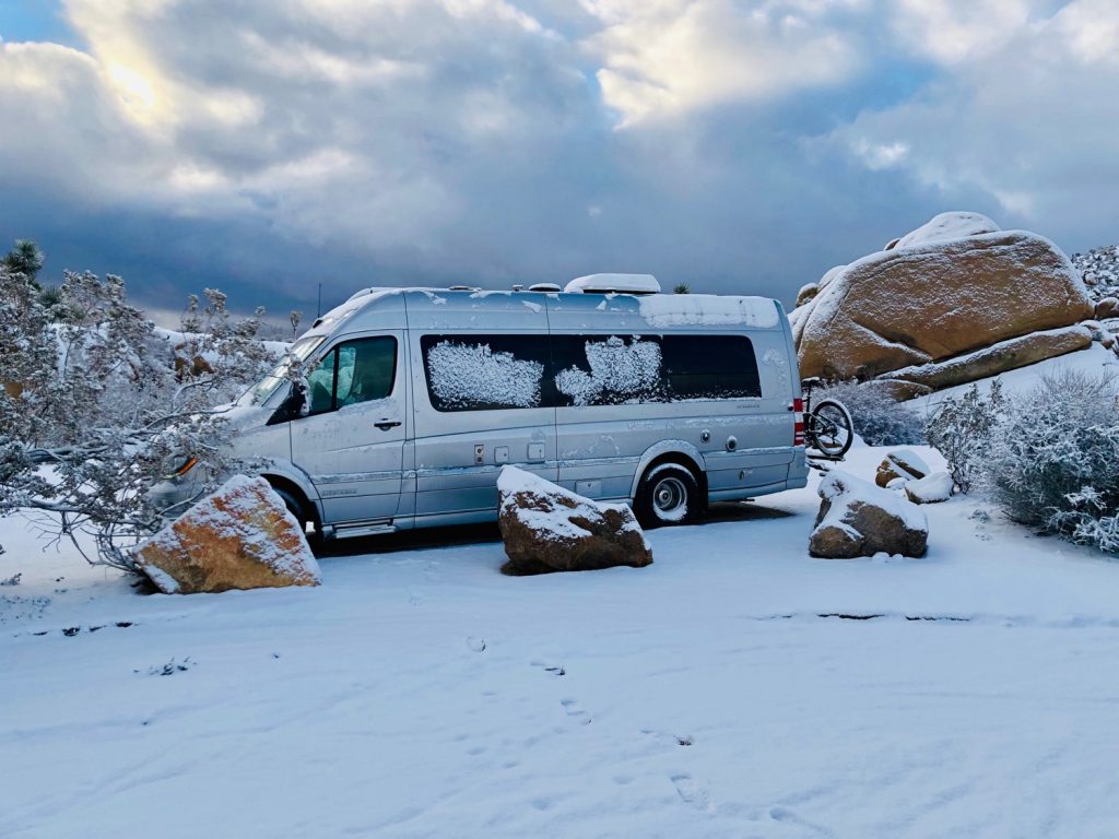
There are eight campgrounds in Joshua Tree National Park. Most of these developed campgrounds are closed for the summer because it is hot, hot, hot here. If you go in the winter, during high-season, reservations are highly recommended or even required for most of the campsites. Of the eight campgrounds, Jumbo Rocks is among the most popular– and is by-reservation only. Jumbo Rocks offers both a surreal landscape and a very central location in the park, making it a great home base for exploring the different corners of Joshua Tree. It’s also above 4000 feet in elevation, so it can get cold– and even snow– in the winter. Some of the campsites are nested in between the large rocks while others are more exposed. The park campground map does a good job of illustrating the interspersion of rock formations and campsites if you want to plan ahead and be situated “in the rocks”.
Exploring Joshua Tree
If you’re coming in on Hwy 62 from the north side of the park, an important thing to know is that the main Visitors Center is located in the town of Joshua Tree, several miles outside of the park. If you’re like me and like to make the Visitors Center your first stop at a National Park, you’ll want to note its location in Joshua Tree and stop by before you head up to the park entrance. I didn’t know this ahead of time and had to drive all the way back out of the park and then re-enter, waiting in a long line at the Joshua Tree entrance station. If you’re arriving during peak hours (especially on the weekend) you may want to stop by the Visitors Center and then drive a few more miles east past the town of Joshua Tree to the TwentyNine Palms entrance station, which receives far fewer visitors. From there you can loop back and exit the Joshua Tree entrance station– giving you a complete look at both the northeast and northwest sides of the park. If you also want to visit the south side of the park, you can loop back and take Pinto Basin road out to the Cottonwood visitor center and then catch I-10 about 15 miles west of Indio.
Hidden Valley
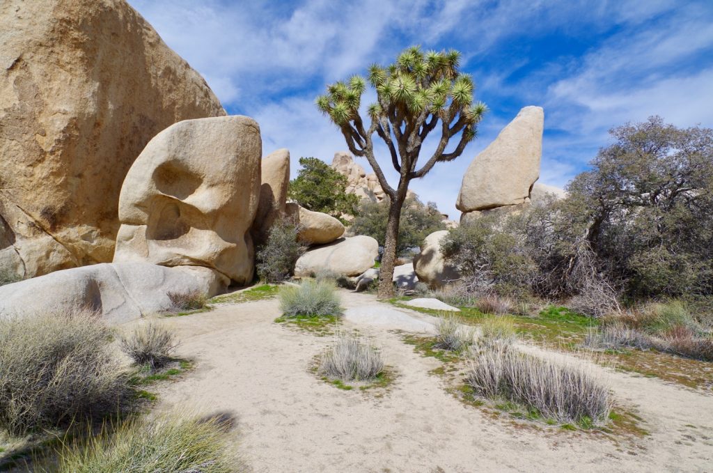
Once you’ve oriented yourself at the visitor center and get your map in hand– there are a number of options to explore in the park. I started at the Hidden Valley area, which offers a hub of activity for visitors entering the northwest side of the park. There is a campground, which is popular with climbers because of the many climbable rock formations in the area, a large picnic area and parking facilities, and several hiking trails to explore. Of all the different areas of the park, I found Hidden Valley to offer some of the most stunning examples of large Joshua trees. Interspersed with the large rocks that litter the landscape, these trees look almost cartoonish– like they fell out of the pages of Dr. Seuss book. You can wander around the large open fields surrounding Hidden Valley to get a close up look at the Joshua Trees, climb the rock formations, or hike on the 1 mile nature trail that takes you into Hidden Valley itself. You can also hike out to Barker Dam, a reservoir built by early cattle ranchers. Less than a mile south on Park Blvd there is another short nature trail which circles around Cap Rock, one of the larger rock formations in the park. I highly recommend all three of these, especially if you’re looking to capture great photos of this unique landscape. This was among the most photogenic sections of the park.
From Hidden Valley, it’s just a short 15 minute drive to Keys View, the highest point in the park. At the Keys View overlook, after walking a .25 mile path, you can look down over the Coachella Valley, the Salton Sea, and Palm Springs. Be prepared for crowds up there and potentially waiting for parking– but it’s worth it once you get to the top. If the nature path wasn’t enough of a workout for you, you can stop at the Lost Horse Mine trailhead on your way back towards Hidden Valley and do either a 4 mile out and back or 6.5 mile loop to an old gold mine– the Lost Horse Mine.
Skull Rock and Split Rock Loop Trail
After exploring Hidden Valley and the Keys View areas, I headed back to Jumbo Rocks campground. If you’re a phone junky, one of the few places you can get signal is just at the top of the hill coming back from the Hidden Valley area to Jumbo Rocks. There is about a 1-mile strip of Park Blvd that has signal– blink and you’ll miss it. Once you’re back at Jumbo Rocks, you’ll be untethered from the digital world once again. I’ve been to a lot of campgrounds and Jumbo Rocks is in simple terms, a really nice place to be. If you’re lucky enough to score a campsite here, make sure you plan time to hang out by the fire, read a book, and just take it all in.
There are also a number of good trails to explore directly from the campground. One of the most popular highlights near the campground is Skull Rock trail. Skull rock is a rock– that looks like a skull. And for some unknown reason, I failed to take a photo of said Skull, so you will have to Google it. But it’s a great morning hike, with the sun rising to the east of Skull Rock. Just don’t forget to take a picture like I did!
From Skull Rock trail you can connect to Split Rock Loop trail and add another 2 miles or so to your hike. Split Rock Loop trail takes you through the high desert landscape, across desert washes, and through some excellent examples of desert plants and cacti. I’d highly recommend this trail for groups with children. It’s short, relatively flat, and can be accessed directly from the Split Rock picnic area if you’re just day-tripping it.

To get back to the Jumbo Rocks campground, you reconnect with the Skull Rock loop by traversing a short wash. One of the really cool features, as you exit the area, is the natural “plumbing” that has evolved in the rock formations. For the final leg of the trail, you walk through a natural aqueduct cut deep into the rocks.

Cholla Cactus Garden and Cottonwood Spring Oasis
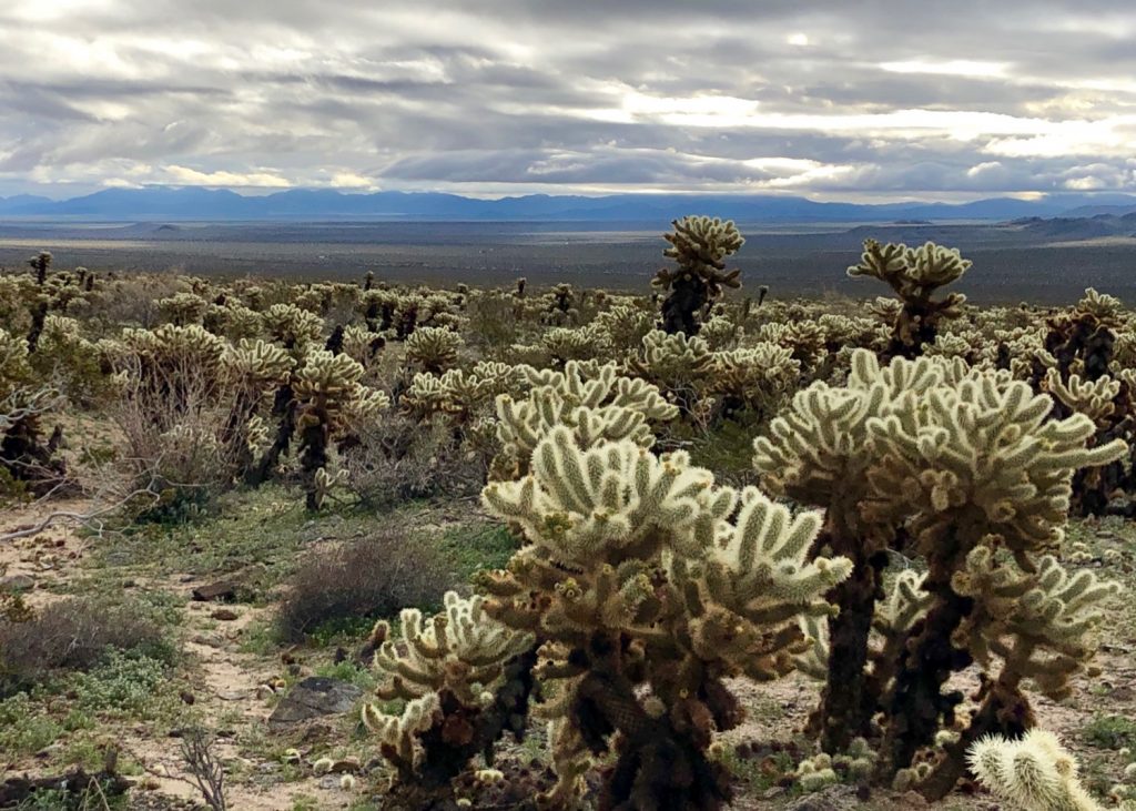
For the final day in the park, I woke up early and headed out Pinto Basin Road to drive south to the Cottonwood section of the park. On the way there, you will find one of the most beautiful highlights in the park– the Cholla Cactus Garden. In the early morning, when the sun hits these Cholla cactus at just the right angle, they glow as if they are lit with electricity. It’s truly a stunning sight. This garden also marks the transition between the Mojave and Colorado deserts. It’s quite the segue, courtesy of nature!
Just a few miles beyond the cactus garden is the Cottonwood section of the park. I had planned to do the 7-mile Lost Palms Oasis hike, but since rain was in the forecast, I chickened out. If you want to see an oasis while you’re in the park, you don’t have to do the 7-mile hike. At the end of Cottonwood road, behind the Cottonwood visitor center, you can drop into Cottonwood Springs Oasis with a short .5 mile hike out and back. The oasis contains a number of Desert Fan palms– these are the great Sequoias of palm trees– growing up to 75 feet tall with leaves nearly six feet wide and long. Joshua Tree has five Desert Fan palm oases, and Cottonwood Oasis is among the easiest to access.
There are many more things to do in Joshua Tree National Park. I just barely scratched the surface during this trip. I’d love to return and spend some more time taking the longer hikes and trek deeper into the park. The namesake trees are dazzling in real life, but so is the rest of the park. Until next time!


